Cool and humid weather in Southern California is set to continue through today, the 12th, before giving way to returning seasonal temperatures, warming, and Santa Ana winds later this week.
According to the National Weather Service (NWS), daytime highs will hover mostly in the 60s Fahrenheit through the 12th. This is 10 to 20 degrees below normal, and some areas may see a 5% to 10% chance of isolated thunderstorms.
Starting on the 13th, high pressure will expand, causing rain clouds to quickly clear and temperatures to trend upward. The NWS forecasts that daytime highs in parts of the Inland Empire could spike up to 86 degrees Fahrenheit this weekend.
Dry Santa Ana winds are then analyzed to arrive between the 15th and 16th. Peak gusts are expected to reach 50 to 75 mph in the San Gabriel Mountains and 35 to 55 mph in the valleys of LA and Ventura counties.
A coastal flood advisory issued for coastal areas remains in effect until 2 p.m. on the 13th.
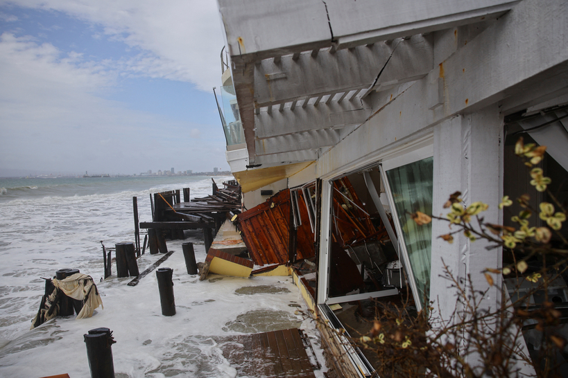
Meanwhile, high waves driven by Tropical Storm Rachel battered the Long Beach coastal area throughout the weekend, causing significant damage to nearby luxury homes. Authorities have declared at least 13 homes uninhabitable, and some properties are reportedly facing collapse risks.