A wildfire in Aguanga has burned 331 acres after two separate fires—originally called the Dale Fire and Bradford Fire—merged on July 16, 2025, according to the Riverside County Fire Department.
The fire was first reported at 12:34 p.m. near Lugo Road and Highway 371. Crews said it was spreading at a moderate speed and called for additional support. The two fires were later combined and are now being managed as a single incident, named the Dale Fire.
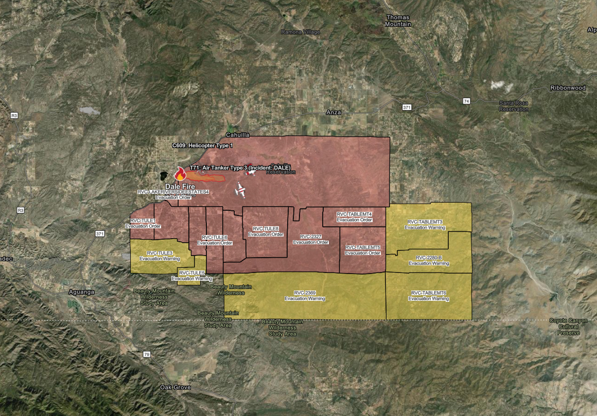
Mandatory evacuation orders have been issued for the following zones:
- RVC-TULE1
- RVC-TULE2
- RVC-TULE4
- RVC-TULE6
- RVC-TULE7
- RVC-TULE8
- RVC-2327
- RVC-LAKERIVERSIDEESTATES4
- RVC-TABLEMT4
- RVC-TABLEMT5
- CBI-CAHUILLA-1
Evacuation warnings are in effect for:
- RVC-TULE3
- RVC-TULE5
- RVC-2369
- RVC-2280-B
- RVC-TABLEMT3
- RVC-TABLEMT6
The affected evacuation area includes the region north of Tule Peak Road, south of Highway 371, west of Eagle Nest Court, and east of Bradford Hills Road.
A shelter has been opened at the Anza Community Center, located at 56630 Highway 371, Anza. For animal evacuations, the Riverside County Department of Animal Services is operating a shelter at 581 S. Grand Avenue, San Jacinto, CA 92582.
The California Highway Patrol has closed Highway 371 in both directions.
The cause of the Dale Fire remains under investigation.


